
Chukai Travel Guide
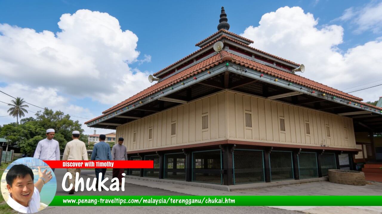 Chukai Travel Guide (AI generated on 10 September 2026)
Also available: Panduan Melawat Chukai
Chukai, also commonly written as Cukai and sometimes referred to as Bandar Kemaman, is the principal town and administrative centre of Kemaman District in southern Terengganu. Situated near the mouth of the Kemaman River, the town developed from a riverine settlement into an important commercial centre serving the southern part of the state. Today, Chukai is surrounded by a mixture of traditional villages, residential areas, commercial districts, industrial development, rivers, beaches and agricultural land.
Quick Facts
- Country: Malaysia
- State: Terengganu
- District: Kemaman
- Role: District capital and principal commercial centre of southern Terengganu
- Local authority: Kemaman Municipal Council (MPK)
- Location: Near the mouth of the Kemaman River, in southern Terengganu
- Nearby state: Pahang lies immediately south of Kemaman District
- Main economic activities: Commerce, services, petroleum and gas, manufacturing, fishing and related industries
- Main access road: East Coast Expressway (E8) and Federal Route 3
- Nearest major airport: Sultan Haji Ahmad Shah Airport in Kuantan, Pahang
- Other nearby airport: Kerteh Airport, subject to its current flight schedule
- Known for: Kemaman food, Kuala Kemaman, satar, otak-otak, keropok, beaches, mangroves, fireflies and its proximity to Cherating
- Recommended stay: 1–2 nights for Chukai and nearby attractions
About Chukai
Chukai is one of the most important towns in southern Terengganu. While Kuala Terengganu serves as the state capital, Chukai functions as the administrative and commercial centre of Kemaman District, a large district stretching from the Pahang border northwards towards Dungun District.
The town's position gives it an interesting character. It is close enough to the coast to retain strong fishing and maritime traditions, yet it also serves a district whose modern economy has been heavily influenced by petroleum, natural gas, manufacturing and port-related activities. The Kemaman Municipal Council describes the district as a strategic centre for the petroleum and gas industry and an important economic hub on the east coast.1
For travellers, Chukai is useful as a base for exploring southern Terengganu. It is close to Kuala Kemaman, several beaches, the Kemaman Recreational Park and Zoo, the Sungai Yak Yah firefly area and other coastal attractions. Cherating, just across the Terengganu-Pahang border, is also within easy reach.
Geography and Setting
Chukai is located in Kemaman District, at the southern end of Terengganu. The district borders Dungun District to the north and Pahang to the south. This makes Kemaman one of the principal gateways into Terengganu for travellers arriving from the direction of Kuantan and the southern east coast.1
The physical geography of Kemaman can broadly be divided into three zones: the coastal plain, inland areas and foothill areas. Chukai itself lies within the lowland environment associated with the Kemaman River and its coastal plain.
The Kemaman River has played an important role in the history of the town. The river reaches the South China Sea at Kuala Kemaman, while the town of Chukai developed farther upstream from the river mouth. The river environment includes mangroves and other wetland habitats, while the surrounding district contains beaches, villages, plantations and forested hills.
This varied landscape helps explain why Kemaman has developed several different economic activities. Fishing and agriculture have long been important, while petroleum and gas, manufacturing, logistics and tourism have become increasingly significant in the modern period.
History of Chukai and Kemaman
Early Settlement
The early history of Kemaman is partly based on oral traditions because surviving written records for the earliest settlement period are limited. According to local historical accounts, the area was settled by Malay groups several centuries ago, with Che Wan Teh, described in local tradition as a nobleman from Pahang, associated with the early opening of settlements in Kemaman.
One traditional account says that Che Wan Teh and his followers initially settled around Bukit Mengkuang. They subsequently moved towards Tanjung Geliga near the coast, before eventually establishing a settlement on the banks of the Kemaman River. This settlement became known as Cukai or Chukai.2
Another historical tradition associates the later development of Kemaman with Lebai Saras, described as a nobleman from Pattani. These accounts place his activities in the early 19th century during the reign of Sultan Ahmad Shah I of Terengganu. The relationship between the two traditions is not entirely clear, and the early history of the district should therefore be treated with some caution.
What is more certain is that the river and coastal environment provided the basic geographical foundation for settlement. The Kemaman River offered access to the interior, while the coast connected the area with maritime trade and fishing communities.
Kemaman as an Early Trading Area
Historical references have associated ancient Kemaman with the name Kole. A parliamentary publication on Kemaman notes that historians have associated the ancient name "Kole" with Kemaman, while "Primula" was associated with Kuala Terengganu.3
Such references are important because they suggest that the southern Terengganu coast was known within the wider geographical and trading world long before the emergence of modern Chukai. The precise identification of ancient place names, however, should not be confused with a continuous written record of the present town.
Colonial and Modern Development
During the colonial period, the river and coastal settlements remained important for local trade and transportation. Chukai gradually developed into the principal administrative and commercial centre of Kemaman.
The development of roads and later modern transport networks reduced the dependence on river transportation. Chukai's position along the main east-coast road between Kuantan and Kuala Terengganu then became increasingly important.
The modern economic history of Kemaman changed substantially with the development of the petroleum and gas industry. The growth of Kerteh, the establishment of industrial facilities and the development of Kemaman Port created new employment and commercial opportunities throughout the district.
The Kemaman Municipal Council identifies petroleum and gas-related industry as a major pillar of the district's modern industrial economy. The development of the East Coast economic corridor and Kemaman Port also contributed to the upgrading of the local authority to municipal status.1
How Chukai Got Its Name
The name Chukai is commonly written as Cukai in modern Malay. The word cukai means "tax" or "taxes" in Malay. The spelling Chukai reflects an older spelling convention that was used before the modern Malay spelling system was introduced.
A commonly repeated explanation is that the settlement acquired the name because taxes or levies were collected from river traffic using the Kemaman River. The river's position as a route for transporting goods would have made it a logical place for such collections.
There is, however, another strand of local tradition concerning the name. Some oral accounts associate the name with the early settlement of Che Wan Teh and events surrounding the opening of Kampung Cukai. Because the early history of Kemaman contains several oral traditions and limited written documentation, these stories should be presented as traditions rather than established historical fact.
The name Kemaman itself has also been given several traditional explanations. One local tradition connects it with the maman plant and another with an animal described in older accounts. None of these explanations can be treated as a definitively established etymology without stronger documentary evidence.
The Modern Town
Modern Chukai is a commercial town rather than a conventional resort destination. Its central area contains shops, restaurants, banks, government offices, hotels, schools and other services serving residents from throughout Kemaman District.
The town has a relatively extensive road network and a substantial supply of public parking. The Kemaman Municipal Council currently lists more than 3,500 parking spaces in designated areas around Chukai and Kemaman town, reflecting the role of the town as a busy commercial centre.4
Visitors should therefore think of Chukai as a working district town with tourism attractions in its surrounding area, rather than as a beach resort. This distinction is useful when planning accommodation and sightseeing.
Things to See and Do Around Chukai
Kuala Kemaman
Kuala Kemaman is a traditional fishing settlement near the mouth of the Kemaman River. It provides a useful contrast with the commercial environment of Chukai and offers a glimpse into the district's older maritime way of life.
The village is particularly associated with local seafood products and traditional foods such as satar, otak-otak and keropok. The Municipal Council specifically identifies Kuala Kemaman as a location for these foods.5
A visit to Kuala Kemaman is best combined with a meal or food stop rather than treated solely as a sightseeing attraction. The village's value lies in the combination of its fishing heritage, local food traditions and coastal environment.
Kemaman Recreational Park and Zoo
Kemaman Recreational Park and Zoo is located at Kampung Ibok, inland from Chukai. The complex combines a zoo with recreational facilities and gardens. The Municipal Council states that the park covers about 35 acres and includes animal exhibits, tropical plant areas, gardens and a water-based recreational area.6
The attraction is particularly suitable for families. It also has an educational role, introducing visitors to local and exotic animal species as well as plants and natural habitats.
Because opening hours, admission arrangements and facilities can change, visitors should check the latest information before travelling.
Sungai Yak Yah
Sungai Yak Yah, sometimes written as Sungai Yak Yah or Sungai Kak Yah, is one of the natural attractions associated with Kampung Ibok. The river passes through mangrove habitat and has become known for its fireflies.
Boat trips provide an opportunity to experience the mangrove environment. The Kemaman Municipal Council has promoted river cruises along Sungai Yak Yah, although operating times and booking arrangements can change.7
For the best chance of seeing fireflies, an evening visit is appropriate. Visitors should avoid using bright lights or making excessive noise because the attraction depends on a relatively dark and quiet river environment.
Teluk Mak Nik Beach
Teluk Mak Nik Beach, also known as Monica Bay, is a coastal recreation area at Geliga. The beach has facilities including rest shelters, a playground, kiosk, public toilets, parking and paved access roads.8
The beach is also associated with turtle conservation. During the appropriate season, visitors may learn about sea-turtle nesting and hatchery activities, subject to the operation of the conservation facility and natural conditions.
Teluk Air Tawar Beach
Teluk Air Tawar Beach is another coastal recreation area within Kemaman District. It is used for picnicking and has resort or chalet accommodation nearby.9
It is more appropriate for a relaxed coastal stop than for a tightly scheduled sightseeing itinerary. As with other beaches on the east coast, visitors should take local advice about sea conditions before swimming.
Bakau Tinggi
Bakau Tinggi is associated with the mangrove and river environment around Chukai. The area provides opportunities for appreciating the wetland landscape and is part of the broader natural environment created by the Kemaman River system.
The mangrove landscape is especially significant because much of Kemaman's traditional economy and settlement pattern developed around rivers, estuaries and the sea. Exploring these areas provides a useful complement to the town's industrial and commercial side.
Kemaman's Other Beaches
Chukai can also serve as a base for visiting beaches elsewhere in Kemaman District. The Municipal Council lists a number of coastal recreation areas, including Kemasik Beach, Telaga Simpul Beach, Penunjuk Beach, Bukit Tampin Beach, Teluk Puchong Beach, Kuala Kerteh Beach, Cagar Hutan Beach and Ma' Daerah Beach.10
Some of these beaches are considerably farther from Chukai than others. Visitors should therefore check distances before attempting to visit several of them on the same day.
Cherating
Cherating is technically in Pahang rather than Terengganu, but its proximity makes it a practical addition to a Chukai itinerary. The resort area lies just south of the Terengganu-Pahang border and is known for its beach, traditional village atmosphere and tourism facilities.
For travellers staying in Chukai, Cherating can be treated as a day trip or as part of a longer journey southwards towards Kuantan.
What to Eat in Chukai
Food is one of the strongest reasons to include Chukai and Kemaman in an east-coast road trip. The district's cuisine reflects its coastal setting, with fish and other seafood featuring prominently in traditional dishes.
Satar
Satar is perhaps the food most closely associated with Kemaman. It consists of seasoned fish paste wrapped in banana leaves and grilled over a fire. The result is smoky, savoury and distinctly fish-based.
Satar is particularly associated with Kuala Kemaman, and the Municipal Council lists it among the local foods visitors can seek out there.5
Otak-otak
Otak-otak is another fish-based food associated with Kuala Kemaman. The local version is prepared with seasoned fish and cooked using traditional methods. It is commonly eaten as a snack or as part of a meal.
Keropok
Keropok is another important local food. Freshly prepared fish-based keropok can be found in the Kemaman area, while packaged varieties are practical for visitors who want to take some home.
Other Terengganu Foods
Visitors can also look for nasi dagang, nasi kerabu, laksam, pulut lepa and other dishes commonly found in Terengganu. Because Chukai is a working commercial town, visitors will find a mixture of traditional Malay eateries, coffee shops, food courts, restaurants and modern cafés.
Markets and Shopping
Chukai has the commercial infrastructure expected of a district capital, including supermarkets, shops and smaller local businesses. Traditional food and everyday goods are often more interesting for visitors than conventional souvenirs.
One way to experience local life is to visit a pasar malam. The Kemaman Municipal Council currently lists night or weekly markets at several locations around Chukai and the wider district, including Jalan Padang in Taman Bandar Chukai, Geliga and Kuala Kemaman.11
Market schedules can change, particularly during public holidays and Ramadan, so visitors should check current information locally rather than relying on an old timetable.
Where to Stay in Chukai
Chukai has a broad range of accommodation suitable for business travellers, families, road-trippers and visitors using the town as a base for exploring Kemaman.
The Kemaman Municipal Council currently lists accommodation establishments including hotels and inns around Jalan Sulaimani, Jalan Jakar, Jalan Kampung Tengah, Jalan Abdul Rahman, Jalan Kubang Kurus and Jalan Air Putih.12
- Town centre: The most convenient choice for restaurants, shops, markets and local services.
- Jalan Sulaimani and Jalan Jakar: Practical areas for visitors who want to remain close to the commercial centre.
- Chukai Utama: A more suburban option with accommodation and commercial facilities.
- Outlying coastal areas: Better suited to visitors whose priority is a beach or resort experience rather than the town itself.
For a short sightseeing visit, staying in central Chukai is usually the most practical option. For a holiday centred on beaches, Cherating or a coastal resort elsewhere in Kemaman may be more appropriate.
How to Get to Chukai
By Car
Driving is the easiest way to reach Chukai and to explore Kemaman District. The East Coast Expressway (E8) provides a high-speed connection from the Klang Valley through Pahang towards Terengganu.
The Chukai Interchange, Exit 841, provides access to Chukai from the East Coast Expressway. From the interchange, motorists can continue towards the town using the local road network.13
Travellers using the coastal route can also use Federal Route 3, which runs along the east coast. This route is particularly useful for those who want to combine Chukai with other coastal towns and attractions rather than simply travelling as quickly as possible.
From Kuantan
Chukai is relatively close to Kuantan, making the Pahang capital an important transport connection for visitors arriving from the south. By road, Chukai is roughly an hour from Kuantan under normal traffic conditions, although actual travel time depends on the route and traffic.
By Bus
Express buses connect Kemaman with other towns and cities on the east coast and beyond. The Kemaman Municipal Council states that the express bus terminal is located in the town centre and is served by several operators.14
Bus travel is therefore a realistic option for visitors without a car, particularly those travelling between Chukai, Kuantan and Kuala Terengganu.
By Air
The nearest airport of practical relevance is Sultan Haji Ahmad Shah Airport in Kuantan, Pahang. The road journey from Chukai to the airport is roughly 70 kilometres, although the actual distance depends on the starting point and route.15
Kerteh Airport is geographically closer to Chukai, but its usefulness to ordinary travellers depends on the flight services operating at the time of travel. Travellers should check the current schedule before choosing it as their arrival airport.
Getting Around Chukai
A private car is the most convenient form of transport for visitors who intend to explore the wider Kemaman area. Attractions such as Kuala Kemaman, the Kemaman Recreational Park and Zoo, Sungai Yak Yah and the beaches are spread across a considerable area.
Taxis and other local public transport services are available. The Municipal Council also lists bus services, taxis and passenger vans as public transport options within Kemaman District.14
E-hailing may be useful for individual journeys around the town, but visitors should not assume that a car will always be readily available in more remote parts of the district, especially late at night.
Walking is practical around parts of central Chukai, particularly for visiting shops, restaurants and local services. It is not practical, however, for an itinerary that includes several attractions around Kemaman District.
How Long to Stay in Chukai
One night is sufficient for travellers who are passing through Chukai on a longer east-coast road trip. A two-night stay is better for visitors who want to explore the town, sample its food and visit several nearby natural attractions.
One-Day Visit
- Explore central Chukai.
- Have lunch featuring local Kemaman food.
- Visit Kuala Kemaman.
- Spend the late afternoon at a nearby beach.
- Return to town for dinner.
Two-Day Visit
- Explore Chukai and its food scene.
- Visit Kuala Kemaman and try satar, otak-otak and keropok.
- Visit Kemaman Recreational Park and Zoo.
- Take a Sungai Yak Yah river trip if operating.
- Visit Teluk Mak Nik Beach or another nearby beach.
- Spend the evening at a local market or restaurant.
Suggested Chukai Itinerary
Day 1: Town, Food and Kuala Kemaman
- Arrive in Chukai and check into your hotel.
- Explore the central commercial area.
- Have a local lunch.
- Continue to Kuala Kemaman.
- Try satar, otak-otak and keropok.
- Visit a nearby beach towards evening.
- Return to Chukai for dinner.
Day 2: Nature and Wildlife
- Visit Kemaman Recreational Park and Zoo.
- Explore the surrounding natural environment.
- Take a Sungai Yak Yah boat trip, subject to current operating arrangements.
- Continue to Teluk Mak Nik or another suitable beach.
- Return to Chukai for dinner.
When to Visit Chukai
Chukai can be visited throughout the year, but weather is an important consideration because many of the district's attractions are outdoors. The east coast experiences the northeast monsoon, which can bring heavier rain and rougher sea conditions during the monsoon season.
For a trip centred on food, shopping and the town itself, rainy weather is less disruptive. For beach visits, river cruises and other outdoor activities, visitors should check the weather forecast before setting out.
The sea can become particularly rough during the northeast monsoon. Visitors should not enter the water when conditions are unsafe, even if a beach appears quiet and attractive.
Chukai and the Petroleum Economy
One of the distinctive features of Chukai is the contrast between its traditional coastal identity and the modern petroleum economy of Kemaman District.
The development of Kerteh as a major petroleum and petrochemical centre transformed the economic landscape of southern Terengganu. Chukai became an important service and commercial centre for the wider district, while Kemaman Port developed an important role in industrial and maritime activities.
This industrial dimension is worth remembering when visiting Chukai. The district is not simply a rural coastal area. It is also one of the important industrial regions of Terengganu, and its modern economy has been shaped significantly by petroleum, natural gas and related industries.1
Chukai as a Gateway to Southern Terengganu
Chukai's greatest practical advantage for travellers is its position. It lies between the larger urban centres of Kuantan and Kuala Terengganu, while Kerteh, Kijal, Kemasik and Dungun are accessible along the Terengganu coast.
It is therefore useful as a stop on a road trip along the east coast. Travellers heading north can continue towards Kerteh, Paka, Dungun and Kuala Terengganu, while those travelling south can continue into Pahang towards Cherating and Kuantan.
The town also provides a practical base for exploring attractions that are too spread out to experience conveniently without private transport. This makes Chukai more useful as a regional base than as a destination where every attraction is concentrated within the town centre.
Practical Travel Tips
- Use Chukai as a base: The town is particularly convenient for exploring Kemaman District by car.
- Try the local seafood: Kuala Kemaman is especially worth visiting for satar, otak-otak and keropok.
- Check attraction schedules: Zoo, river cruise and other facilities may have different operating arrangements from time to time.
- Plan outdoor activities around the weather: Heavy rain can affect beaches, river trips and other outdoor attractions.
- Carry some cash: Small food stalls and traditional vendors may not always accept cards or electronic payments.
- Do not confuse Chukai with Kerteh: Both are in Kemaman District, but Chukai is the district's administrative and commercial centre while Kerteh is particularly associated with the petroleum and petrochemical industry.
- Consider a car: A vehicle greatly increases the number of places that can realistically be visited in one day.
- Respect conservation areas: Do not disturb turtles, fireflies, mangroves or other wildlife.
What Makes Chukai Worth Visiting?
Chukai may not have the immediate tourist profile of Kuala Terengganu, Redang or the Perhentian Islands, but it provides a different view of Terengganu. It is a working district town where traditional fishing culture, riverine settlement, local food and modern industry exist alongside one another.
Its greatest attraction is arguably the wider Kemaman landscape rather than a single monument. The combination of Kuala Kemaman's fishing heritage, local seafood, mangrove rivers, fireflies, beaches and wildlife attractions gives the area considerable variety.
For travellers crossing the east coast by road, Chukai is also a useful place to stop, eat and explore. Its location near the Pahang border makes it one of the most important gateways between southern Terengganu and the Kuantan region.
Conclusion
Chukai is the principal town of Kemaman District and one of the important urban centres of southern Terengganu. Its history is closely connected with the Kemaman River, early settlement, maritime trade and the development of the coastal economy. In modern times, petroleum and gas, industry, commerce and port-related activities have given the district a much broader economic role.
For visitors, Chukai is best experienced as a combination of town and surrounding district. A trip should include local food, particularly the specialities of Kuala Kemaman, together with one or more of the nearby beaches, the Kemaman Recreational Park and Zoo or the Sungai Yak Yah area.
Chukai is therefore more than a convenient stopping point between Kuantan and Kuala Terengganu. It offers an opportunity to experience a less resort-oriented side of Terengganu, where fishing villages, rivers, mangroves, local food and a modern industrial economy form part of the same regional landscape.
References
- Background of Kemaman — Kemaman Municipal Council
- Sejarah Asal Daerah Kemaman — Pelancongan Terengganu
- My Local Stats: Kemaman, Terengganu — Parliament of Malaysia
- Parking Services — Kemaman Municipal Council
- Food and Dining in Kemaman — Kemaman Municipal Council
- Kemaman Recreational Park and Zoo — Kemaman Municipal Council
- Sungai Yak Yah Boat Cruise — Kemaman Municipal Council
- Teluk Mak Nik Beach — Kemaman Municipal Council
- Teluk Air Tawar Beach — Kemaman Municipal Council
- Places of Interest in Kemaman — Kemaman Municipal Council
- Night and Weekly Markets in Kemaman — Kemaman Municipal Council
- Accommodation in Kemaman — Kemaman Municipal Council
- East Coast Expressway (E8) — Penang Travel Tips
- Transportation in Kemaman — Kemaman Municipal Council
- Chukai to Kuantan Airport — Rome2Rio
Page Details
This page was created on 10 September 2026. Hi, my name is Timothy and created it from my research, for my own entertainment, knowledge and to satisfy my curiosity. I am providing the information to you in good faith and hope it is useful. I try to get the details as accurate as possible. I also try to update the page whenever I stumble on new details. So this and all my other pages are perpetual work in progress. If you discover any error, please politely inform me, pointing out where the error lies, and I will correct it as soon as possible. Your helpfulness will keep this page accurate, relevant and helpful to those who need the information.Buy Me A Coffee
If you enjoy the information I provide and want to support the work I do, please buy me a coffee! I appreciate it immensely, thank you so much!
